GSSI releases improved StructureScan Mini XT GPR
GSSI, the world’s leading manufacturer of ground penetrating radar (GPR) equipment, announces the release of a major software update for the StructureScan™ Mini XT – the newest generation of GSSI’s popular all-in-one concrete inspection GPR system.
The update expands StructureScan™ Mini XT capabilities with an increased depth range, improved Focus Mode, and a new Auto Drill feature.
The update increases StructureScan™ Mini XT’s depth range by 20% to up to 24 inches for greater visibility in survey situations involving thick structural concrete and slab on grade. Additionally, algorithm improvements enhance the StructureScan™ Mini XT’s gain at greater depths.
The improved Focus Mode uses input from the StructureScan™ Mini XT’s 2.7 GHz high-resolution antenna to resolve closely spaced and bundled targets within concrete, offering precise visualization where traditional GPR hyperbolas would condense data into a singular dot.
Users can sweep between raw GPR data and the easy-to-read focused view. The new Auto Drill feature searches for potential obstructions to a planned core location. The innovative software tool uses a specialized algorithm to identify possible obstacles to drilling operations by analysing a user-selected position and size (1/2’ to 6”) on a 3D grid.
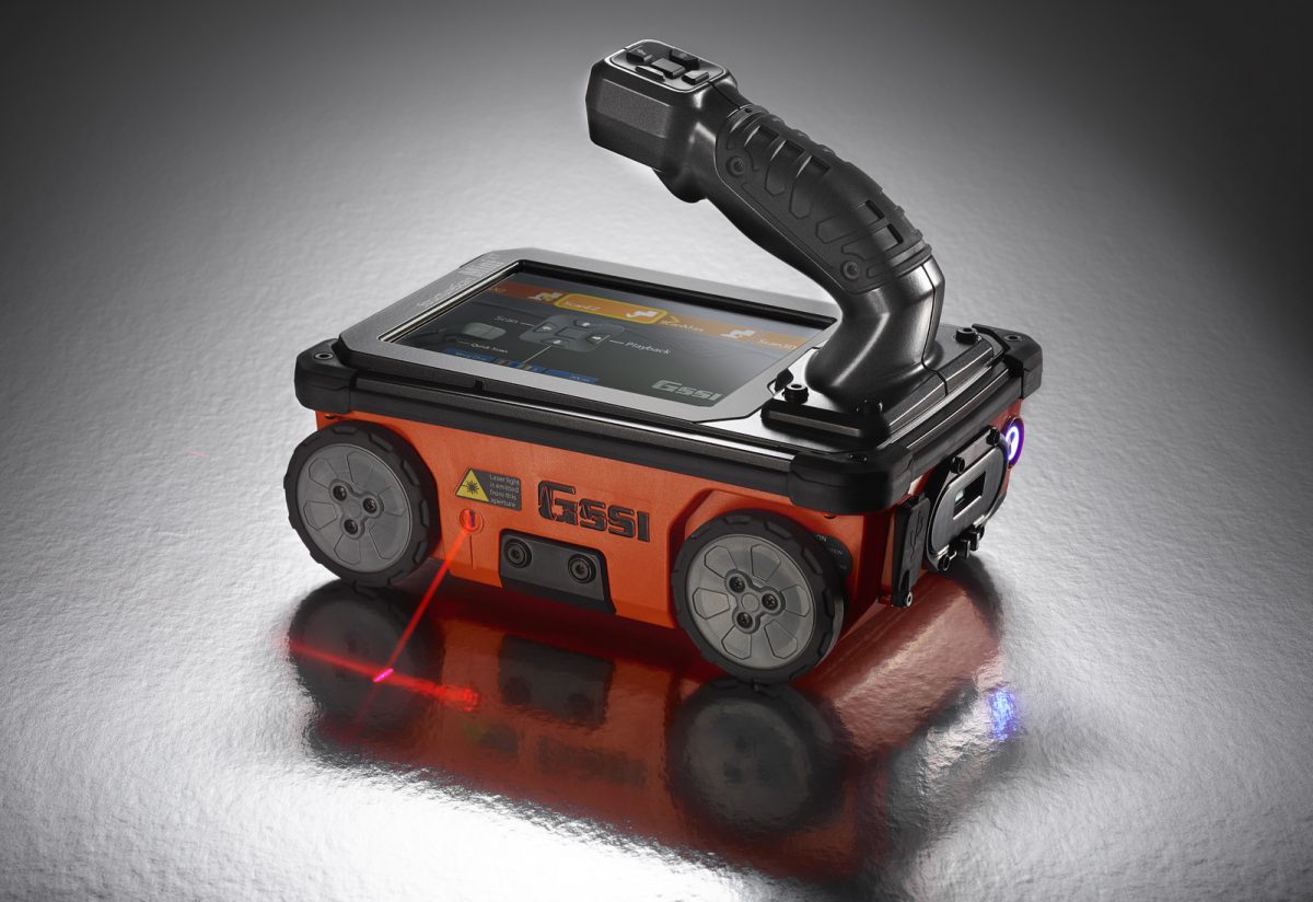
Rugged, compact, and flexible, StructureScan™ Mini XT is ideal for locating rebar, conduits, post-tension cables, and voids.
The integrated all-in-one concrete inspection tool can help identify structural elements, including pan deck and concrete cover, and can also provide real time determination of concrete slab thickness. StructureScan™ Mini XT comes with an antenna, positioning system, and control unit combination that features an intuitive touchscreen interface and six-button control options.
Use the QuickScan mode to collect data with the push of one button, or select ScanMax and Scan3D modes for advanced data interpretation and visualization. Real-time migrated data, onscreen reference markers and real-time signal floor indicator are also available.